13176_23418_1950s_New_York_City_01
Here’s a clip showcasing a certain section of New York City during the early 1950s.
The clip begins with a graphic showing the globe, focused on the United States. The camera zooms in to New York state, and the shot quickly dissolves into an aerial view of Manhattan, looking eastward from the Hudson River.
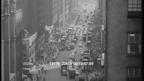
Then there is an aerial view looking “down” Manhattan from a point near the upper West Side.
We then see a harbor apparently on the East River; Manhattan is in the background.
An ocean liner passes the Statue of Liberty. Several smaller boats, tug boats, are moving in the foreground.
A map of the northeast features the Hudson Valley, the Mohawk Valley, and Albany, New York's capital, in relation to New York City. White lines appear over this map showing the paths where airplanes, trains, and ships travel to get to New York City.
The map then dissolves into a shot of a NYC harbor. Cargo ships are shown at a dock. White boxes or bundles are being unloaded from one of the cargo ships using a crane and being loaded onto a smaller ship. We also see a truck and a pallet of sacks or bags being moved from one ship to another ship with a crane.
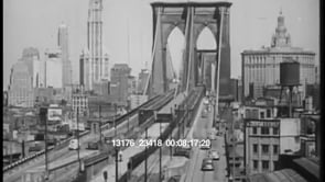
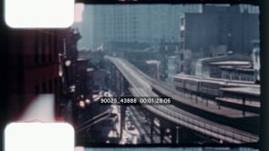
Trains travel beside a river and pass below the camera, which is on a bridge or overpass.
There is then a wide shot of Penn Station. Inside, the station is packed with people.
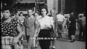
The clip’s final shot shows people leaving Penn Station and walking into the city.